Sweet Water Village, Arizona
CDP in Pinal County, Arizona
CDP in Arizona, United States
Sweet Water Village, Arizona O'odham: S-iʼovĭ Shu:dagĭ | |
|---|---|
CDP | |
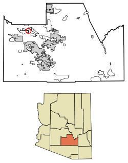 Location of Sweet Water Village in Pinal County, Arizona. | |
| 33°7′12″N 111°50′16″W / 33.12000°N 111.83778°W / 33.12000; -111.83778 | |
| Country | United States |
| State | Arizona |
| County | Pinal |
| Area | |
| • Total | 0.80 sq mi (2.07 km2) |
| • Land | 0.80 sq mi (2.07 km2) |
| • Water | 0.00 sq mi (0.00 km2) |
| Population (2020) | |
| • Total | 123 |
| • Density | 153.75/sq mi (59.38/km2) |
| Time zone | UTC-7 (MST (no DST)) |
| ZIP code | 85128[2] |
| Area code | 520 |
| FIPS code | 04-71642 |
Sweet Water Village (O'odham: S-iʼovĭ Shu:dagĭ)[citation needed] is a census-designated place (CDP) in Pinal County, Arizona, United States, located in the Gila River Indian Community. The population was 83 at the 2010 census.
Demographics
| Census | Pop. | Note | %± |
|---|---|---|---|
| 2020 | 123 | — | |
| U.S. Decennial Census[3] | |||
As of the census[4] of 2010, there were 83 people living in the CDP. The population density was 103.8 inhabitants per square mile (40.1/km2). The racial makeup of the CDP was 1% White, 98% Native American, and 1% from two or more races. 19% of the population were Hispanic or Latino of any race.
Notes
- v
- t
- e
Municipalities and communities of Pinal County, Arizona, United States
County seat: Florence

- Ak-Chin Village
- Arizona City
- Blackwater
- Cactus Forest
- Campo Bonito
- Casa Blanca
- Chuichu
- Dudleyville
- Gold Canyon
- Goodyear Village
- Kohatk
- Lower Santan Village
- Oracle
- Picacho
- Queen Valley
- Red Rock
- Sacate Village
- Sacaton
- Sacaton Flats Village
- Saddlebrooke
- San Manuel
- San Tan Valley
- Santa Cruz
- Stanfield
- Stotonic Village
- Sweet Water Village
- Tat Momoli
- Top-of-the-World‡
- Upper Santan Village
- Vaiva Vo
- Wet Camp Village
places
‡This populated place also has portions in an adjacent county or counties
- Arizona portal
- United States portal


