Rui Chatrapati Dam
Dam in Parner , India
18°55′37″N 74°33′42″E / 18.92694°N 74.56167°E / 18.92694; 74.56167Rui Chatrapati Dam (Marathi: रुई छत्रपती धरण), is an earth-fill dam on Gopal Ganga river in Rui Chatrapati village in Parner taluka of Ahmednagar district of state of Maharashtra in India.
Specifications
The height of the dam above lowest foundation is 10.77 m (35.3 ft) while the length is 420 m (1,380 ft). The gross storage capacity is 1,350 km3 (320 cu mi).[1]
Purpose
- Irrigation
- Drinking water for neatest villages
See also
- Dams in Maharashtra
References
- ^ "Specifications of large dams in India" (PDF). Archived from the original (PDF) on 2011-07-21. Retrieved 2010-10-12.
- v
- t
- e
Parner taluka topics
- Akkalwadi
- Alkuti
- Apadhup
- Astagaon
- Babhulwade
- Baburdi
- Bhalwani
- Bhandgaon
- Bhondre
- Bhoyre Gangarda
- Chincholi
- Chombhut
- Daithane Gunjal
- Darodi
- Desawade
- Devibhoaire
- Dhawalpuri
- Dhoki
- Dhotre Bk
- Diksal
- Ganji Bhoyare
- Gargundi
- Garkhindi
- Gatewadi
- Ghanegaon
- Goregaon
- Gunaore
- Hanga
- Hattalkhindi
- Hiware Korda
- Jadhvawadi
- Jamgaon
- Jategaon
- Jawala
- Kadus
- Kakane Wadi
- Kalas
- Kalkup
- Kanhur Pathar
- Karandi
- Karegaon
- Karjule Harya
- Kasare
- Katalwedha
- Khadakwadi
- Kinhi
- Kohkadi
- Kurund
- Loni Haveli
- Lonimawala
- Mahskewadi
- Map
- Mandave Kd
- Mawale Wadi
- Mhasane
- Mungashi
- Nandur Pathar
- Narayan Gawhan
- Nighoj
- Pabal
- Padali Aale
- Padali Darya
- Padali Kanhur
- Padali Ranjangaon
- Palashi
- Palspur
- Palwe Bk
- Palwe Kd
- Panoli
- Parner
- Patharwadi
- Pimpalgaon Rotha
- Pimpalgaon Turk
- Pimpalner
- Pimpri Gawali
- Pimpri Jalsen
- Pimpri Pathar
- Pokhari
- Punewadi
- Raitale
- Ralegan Siddhi
- Ralegan Therpal
- Randhe
- Ranjangaon Mashid
- Renwadi
- Rui Chatrapati
- Sangvi Surya
- Sarola Adwai
- Sawargaon
- Shanjapur
- Sherikasare
- Shirapur
- Sidheshwar Wadi
- Supa
- Takali Dhokeshwar
- Tikhol
- Vesdare
- Viroli
- Wadegawhan Wadgaon Amali
- Wadgaon Darya
- Wadgaon Savtal
- Wadner Bk
- Wadner Haveli
- Wadule
- Wadzire
- Waghunde Bk
- Waghunde Kd
- Walwane
- Wankute
- Wasunde
- Yadavwadi

- Dhoki Dam
- Hanga Dam
- Lonimavla Dam
- Mandohol Dam
- Palashi Dam
- Rui Chatrapati Dam
- Tikhol Dam
societies
- Rayat Shikshan Sanstha
- Shree Hareshwar Education Society
- SAI Education Society
- Jawahar Navodaya Vidyalaya, Ahmednagar
- Shri Sainath Highschool & Jr. College
- Shree Hareshwar Vidyalaya
- New Arts, Commerce and Science College, Parner
- Pravra Education Society's Arts, Science and Commerce College, Alkuti
- Shri Dhokeshwar Mahavidyalaya, Takali Dhokeshwar
- Senapati Bapat
- Sakharam Bhagat
- Vishnu S Bhagat
- Popatrav Pawar
- Anna Hazare
Ahmednagar district topics | ||
|---|---|---|
| History | 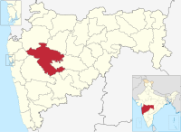 | |
| Geography | ||
| Talukas | ||
| Cities and towns | ||
| Monuments | ||
| Education | ||
| Lok Sabha constituencies | ||
| Vidhan Sabha constituencies | ||
| Dams in District |
| |


