Leroy, Alabama
Census-designated place in Alabama, United States
31°30′17″N 87°59′05″W / 31.50472°N 87.98472°W / 31.50472; -87.98472 (2020)
36548
New Canaan
Possum Corner[2]
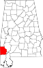
Leroy is a census-designated place located in Washington County, Alabama, around 60 miles (97 km) north of Mobile. As of the 2010 census, its population was 911.[4]
Demographics
| Census | Pop. | Note | %± |
|---|---|---|---|
| 2020 | 766 | — | |
| U.S. Decennial Census[5] | |||
Notable people
- Sammie Coates, NFL wide receiver for the Kansas City Chiefs
- Phillip Ervin, professional baseball outfielder for the Cincinnati Reds
- Emanuel King, former NFL player
- Simmie Knox, American painter
- Kelvin Moore, former first baseman for the Oakland Athletics
- Danny Powell, Alabama baseball coaches Hall of Fame member
- Clifton Covington, Draft Pick of San Francisco Giants
- Clint Mosely, Auburn Quarterback
References
- ^ "2020 U.S. Gazetteer Files". United States Census Bureau. Retrieved October 29, 2021.
- ^ a b c U.S. Geological Survey Geographic Names Information System: Leroy, Alabama. Retrieved on June 16, 2009.
- ^ "Leroy AL". ZIP Code Lookup. Retrieved June 16, 2009.
- ^ "U.S. Census website". United States Census Bureau. Retrieved May 14, 2011.
- ^ "Census of Population and Housing". Census.gov. Retrieved June 4, 2016.
- v
- t
- e
Municipalities and communities of Washington County, Alabama, United States
County seat: Chatom
communities
‡This populated place also has portions in an adjacent county or counties
- Alabama portal
- United States portal
 | This Washington County, Alabama state location article is a stub. You can help Wikipedia by expanding it. |
- v
- t
- e


