Lantry, South Dakota
Unincorporated community in South Dakota, United States
45°01′06″N 101°25′58″W / 45.01833°N 101.43278°W / 45.01833; -101.43278 (2020)[3]
57636
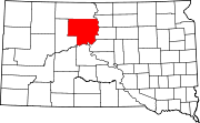
Lantry is an unincorporated community and a census-designated place (CDP) in Dewey County, South Dakota, United States. The population of the CDP was 33 at the 2020 census.[4]
According to the Federal Writers' Project, the origin of the name Lantry is obscure.[5]
Demographics
| Census | Pop. | Note | %± |
|---|---|---|---|
| 2020 | 33 | — | |
| U.S. Decennial Census[6] | |||
Education
It is in the Eagle Butte School District,[7] which jointly operates Cheyenne-Eagle Butte School with the Bureau of Indian Education (BIE).[8]
References
- ^ "ArcGIS REST Services Directory". United States Census Bureau. Retrieved October 15, 2022.
- ^ a b U.S. Geological Survey Geographic Names Information System: Lantry, South Dakota
- ^ "Census Population API". United States Census Bureau. Retrieved October 15, 2022.
- ^ "U.S. Census Bureau: Lantry CDP, South Dakota". www.census.gov. United States Census Bureau. Retrieved February 13, 2022.
- ^ Federal Writers' Project (1940). South Dakota place-names, v.1-3. University of South Dakota. p. 47.
- ^ "Census of Population and Housing". Census.gov. Retrieved June 4, 2016.
- ^ "2020 CENSUS - SCHOOL DISTRICT REFERENCE MAP: Dewey County, SD" (PDF). U.S. Census Bureau. Retrieved August 6, 2021.
- ^ "About". Eagle Butte School District 20-1. Retrieved August 6, 2021.
- v
- t
- e
Municipalities and communities of Dewey County, South Dakota, United States
County seat: Timber Lake
communities
‡This populated place also has portions in an adjacent county or counties
- South Dakota portal
- United States portal
Authority control databases | |
|---|---|
| International |
|
| National |
|
 | This South Dakota state location article is a stub. You can help Wikipedia by expanding it. |
- v
- t
- e


