Hornchurch and Upminster (UK Parliament constituency)
Parliamentary constituency in the United Kingdom, 2010 onwards
| Hornchurch and Upminster | |
|---|---|
| Borough constituency for the House of Commons | |
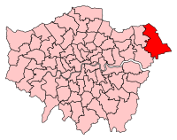 Boundary of Hornchurch and Upminster in Greater London | |
| County | Greater London |
| Electorate | 76,938 (2023)[1] |
| Current constituency | |
| Created | 2010 |
| Member of Parliament | Julia Lopez (Conservative) |
| Seats | One |
| Created from | Hornchurch, Upminster, Romford |
Hornchurch and Upminster is a constituency[n 1] in Greater London most recently represented in the House of Commons of the UK Parliament[n 2] by Julia Lopez, a member of the Conservative Party, currently Shadow Secretary of State for Culture, Media and Sport, who succeeded Angela Watkinson in 2017. Watkinson had been elected in 2010 as the constituency's first MP.
Boundaries

Map of boundaries 2010-2024
2010–present
The London Borough of Havering wards of Cranham, Emerson Park, Gooshays, Hacton, Harold Wood, Heaton, St Andrew's, Upminster.

Further to the 2023 Periodic Review of Westminster constituencies, which was based on the ward boundaries in place on 1 December 2020, the composition of the constituency from the 2024 general election was reduced slightly to bring it within the permitted electoral range. Parts of the Emerson Park ward, primarily that part of polling district EM2 to the west of the River Ravensbourne, were transferred to Romford; and parts of the St Andrew's and Hacton wards, mainly to the west of Abbs Cross Lane and South End Road, were transferred to Dagenham and Rainham.[2] These minor changes largely reflected the revised ward boundaries following a local government boundary review which came into effect in May 2022.[3][4]
History
The seat was the proposal of the Boundary Commission's Fifth Periodic Review of Westminster constituencies in 2008–9 and was after consultation accepted by Parliament. Hornchurch and Upminster is essentially an expansion of the old Upminster seat to include a chunk of the old Hornchurch seat, specifically Hornchurch itself. Most of the western wards of Hornchurch went to the new Dagenham and Rainham seat. The electoral wards in Havering were redrawn in 2022 and subsequently the constituency no longer aligns with ward boundaries.
Constituency profile
The easternmost seat in Greater London, it includes the suburbs of Cranham, Emerson Park, Harold Wood, Hornchurch, Upminster and part of Elm Park. The constituency includes the semi-rural Noak Hill and North Ockendon and the large Harold Hill estate, built by the London County Council and completed in 1958.
There are London Underground stations at Hornchurch, Upminster, Upminster Bridge and another on the boundary at Elm Park. Harold Wood is served by a station on the Elizabeth line and there is a London Overground station at Emerson Park. Upminster is an interchange station with National Rail services on the Fenchurch Street line as well as London Underground and London Overground services.
Pockets of deprivation exist in the north of the constituency.[5] Most output areas have high levels of retired constituents by Greater London standards, and the borough as a whole is similar to the London Borough of Bromley in that it has high levels of home ownership, on statistics compiled in the 2011 UK Census. The seat, like the London borough, is the only one in London that extends beyond the M25 motorway.[6]
The predecessor seats were lost by the Conservatives in Labour's landslide 1997 victory, but Upminster was one of the few Conservative gains in 2001 and Hornchurch was lost by Labour in 2005; this area is now very safe territory for the Conservatives since it gained their strongest areas from Hornchurch in the boundary changes. The 2015 result made the seat the 146th safest of the Conservative Party's 331 seats by percentage of majority.[7] At the 2015 general election, the constituency was one of five in Greater London where the UK Independence Party came in second place.[8]
The constituency is unusual in that for local elections to Havering Council, the Havering Residents Association dominates the results rather than the Conservative Party who have held the seat since it was created.
Members of Parliament
| Election | Member[9] | Party | |
|---|---|---|---|
| 2010 | Dame Angela Watkinson | Conservative | |
| 2017 | Julia Lopez | Conservative | |
Election results
Elections in the 2020s
| Party | Candidate | Votes | % | ±% | |
|---|---|---|---|---|---|
| Conservative | Julia Lopez | 15,260 | 32.5 | −32.9 | |
| Reform UK | Nicholas Palmer | 13,317 | 28.4 | N/A | |
| Labour | Sunny Brar | 12,939 | 27.6 | +4.7 | |
| Green | Melanie Collins | 2,620 | 5.6 | +2.0 | |
| Liberal Democrats | Ian Sanderson | 2,381 | 5.1 | −2.0 | |
| Independent | David Durant | 394 | 0.8 | N/A | |
| Majority | 1,943 | 4.1 | −39.1 | ||
| Turnout | 46,911 | 62.2 | −4.2 | ||
| Registered electors | 75,438 | ||||
| Conservative hold | |||||
Elections in the 2010s

| 2019 notional result[12] | |||
|---|---|---|---|
| Party | Vote | % | |
| Conservative | 33,404 | 65.4 | |
| Labour | 11,669 | 22.9 | |
| Liberal Democrats | 3,634 | 7.1 | |
| Green | 1,836 | 3.6 | |
| Others | 510 | 1.0 | |
| Turnout | 51,053 | 66.4 | |
| Electorate | 76,938 | ||
| Party | Candidate | Votes | % | ±% | |
|---|---|---|---|---|---|
| Conservative | Julia Lopez | 35,495 | 65.8 | +5.6 | |
| Labour | Tele Lawal | 12,187 | 22.6 | −6.0 | |
| Liberal Democrats | Thomas Clarke | 3,862 | 7.2 | +4.8 | |
| Green | Peter Caton | 1,920 | 3.6 | +1.7 | |
| BNP | David Furness | 510 | 0.9 | +0.2 | |
| Majority | 23,308 | 43.2 | +11.6 | ||
| Turnout | 53,974 | 66.8 | −2.6 | ||
| Registered electors | 80,765 | ||||
| Conservative hold | Swing | +5.8 | |||
| Party | Candidate | Votes | % | ±% | |
|---|---|---|---|---|---|
| Conservative | Julia Dockerill | 33,750 | 60.2 | +11.2 | |
| Labour | Rocky Gill | 16,027 | 28.6 | +8.5 | |
| UKIP | Lawrence Webb | 3,502 | 6.2 | −19.1 | |
| Liberal Democrats | Jonathan Mitchell | 1,371 | 2.4 | −0.3 | |
| Green | Peter Caton | 1,077 | 1.9 | −0.7 | |
| BNP | David Furness | 380 | 0.7 | +0.4 | |
| Majority | 17,723 | 31.6 | +7.9 | ||
| Turnout | 56,107 | 69.4 | −0.2 | ||
| Registered electors | 80,802 | ||||
| Conservative hold | Swing | +1.36 | |||
| Party | Candidate | Votes | % | ±% | |
|---|---|---|---|---|---|
| Conservative | Angela Watkinson | 27,051 | 49.0 | −2.4 | |
| UKIP | Lawrence Webb | 13,977 | 25.3 | +20.0 | |
| Labour | Paul McGeary | 11,103 | 20.1 | −0.7 | |
| Liberal Democrats | Jonathan Mitchell | 1,501 | 2.7 | −11.2 | |
| Green | Melanie Collins | 1,411 | 2.6 | +1.6 | |
| BNP | Paul Borg | 193 | 0.3 | −6.1 | |
| Majority | 13,074 | 23.7 | −6.9 | ||
| Turnout | 55,236 | 69.6 | +1.6 | ||
| Registered electors | 79,331 | ||||
| Conservative hold | Swing | -8.7 | |||
| Party | Candidate | Votes | % | ±% | |
|---|---|---|---|---|---|
| Conservative | Angela Watkinson* | 27,469 | 51.4 | ||
| Labour | Kath McGuirk | 11,098 | 20.8 | ||
| Liberal Democrats | Karen Chilvers | 7,426 | 13.9 | ||
| BNP | William Whelpley | 3,421 | 6.4 | ||
| UKIP | Lawrence Webb | 2,848 | 5.3 | ||
| Green | Melanie Collins | 542 | 1.0 | ||
| Independent | David Durant | 305 | 0.6 | ||
| Christian | Johnson Olukotun | 281 | 0.5 | ||
| Majority | 16,371 | 30.6 | |||
| Turnout | 53,390 | 68.0 | |||
| Registered electors | 78,547 | ||||
| Conservative win (new seat) | |||||
- * Served as MP for Upminster in the 2005–2010 Parliament
- The seat was contested for the first time in 2010, so percentage changes are based on notional results of the 2005 election.
Notes
- ^ A borough constituency (for the purposes of election expenses and type of returning officer)
- ^ As with all constituencies, the constituency elects one Member of Parliament (MP) by the first past the post system of election at least every five years.
References
- ^ "The 2023 Review of Parliamentary Constituency Boundaries in England – Volume two: Constituency names, designations and composition – London". Boundary Commission for England. Retrieved 21 June 2024.
- ^ "The Parliamentary Constituencies Order 2023". Schedule 1 Part 3 London region.
- ^ LGBCE. "Havering | LGBCE". www.lgbce.org.uk. Retrieved 29 March 2024.
- ^ "The London Borough of Havering (Electoral Changes) Order 2021".
- ^ "Hornchurch and Upminster". mySociety. Retrieved 28 July 2023.
- ^ "2011 census interactive maps". Archived from the original on 29 January 2016.
- ^ "Conservative Members of Parliament 2015". UK Political.info. Archived from the original on 8 June 2017. Retrieved 12 February 2017.
- ^ Rae, Alasdair (12 May 2015). "The 2015 General Election: London Results". under the raedar. Retrieved 28 July 2023.
- ^ Leigh Rayment's Historical List of MPs – Constituencies beginning with "H" (part 4)
- ^ "Hornchurch and Upminster Statement of Persons Nominated, Notice of Poll and Situation of Polling Stations - 4 July 2024 General Election" (PDF). London Borough of Havering. Retrieved 7 June 2024.
- ^ "Hornchurch and Upminster results". BBC. 5 July 2024. Retrieved 5 July 2024.
- ^ "Notional results for a UK general election on 12 December 2019". Rallings & Thrasher, Professor David Denver (Scotland), Nicholas Whyte (NI) for Sky News, PA, BBC News and ITV News. UK Parliament. Retrieved 11 July 2024.
- ^ Blake-Herbert, Andrew (14 November 2019). "Statement of persons nominated, notice of poll and situation of polling stations. Election of a Member of Parliament for Hornchurch & Upminster" (PDF). Havering London Borough Council.
- ^ "Commons Briefing Paper 8749. General Election 2019: results and analysis" (PDF). London: House of Commons Library. 28 January 2020. Archived (PDF) from the original on 18 November 2021. Retrieved 19 January 2022.
- ^ "Hornchurch & Upminster parliamentary constituency". BBC News.
- ^ "Commons Briefing Paper 7979. General Election 2017: results and analysis" (PDF) (Second ed.). House of Commons Library. 29 January 2019 [7 April 2018]. Archived (PDF) from the original on 12 November 2019.
- ^ "Hornchurch and Upminster - UK Parliament Constituency - Election Polling". www.electionpolling.co.uk.
- ^ "Election Data 2015". Electoral Calculus. Archived from the original on 17 October 2015. Retrieved 17 October 2015.
- ^ Havering, The London Borough Of. "Elections and voting - The London Borough Of Havering". www.havering.gov.uk.
- ^ "Election Data 2010". Electoral Calculus. Archived from the original on 26 July 2013. Retrieved 17 October 2015.
External links
- Politics Resources (Election results from 1922 onwards)
- Electoral Calculus (Election results from 1955 onwards)
- Hornchurch and Upminster, UKPollingReport
- Hornchurch and Upminster UK Parliament constituency (boundaries April 2010 – May 2024) at MapIt UK
- Hornchurch and Upminster UK Parliament constituency (boundaries from June 2024) at MapIt UK
- v
- t
- e
- Barking
- Battersea
- Beckenham and Penge
- Bermondsey and Old Southwark
- Bethnal Green and Stepney
- Bexleyheath and Crayford
- Brent East
- Brent West
- Brentford and Isleworth
- Chelsea and Fulham
- Chipping Barnet
- Cities of London and Westminster
- Clapham and Brixton Hill
- Croydon East
- Croydon West
- Dagenham and Rainham
- Dulwich and West Norwood
- Ealing Central and Acton
- Ealing North
- Ealing Southall
- East Ham
- Edmonton and Winchmore Hill
- Eltham and Chislehurst
- Enfield North
- Erith and Thamesmead
- Feltham and Heston
- Finchley and Golders Green
- Greenwich and Woolwich
- Hackney North and Stoke Newington
- Hackney South and Shoreditch
- Hammersmith and Chiswick
- Hampstead and Highgate
- Harrow West
- Hayes and Harlington
- Hendon
- Holborn and St. Pancras
- Hornsey and Friern Barnet
- Ilford North
- Ilford South
- Islington South and Finsbury
- Kensington and Bayswater
- Lewisham East
- Lewisham North
- Lewisham West and East Dulwich
- Leyton and Wanstead
- Mitcham and Morden
- Peckham
- Poplar and Limehouse
- Putney
- Queen's Park and Maida Vale
- Southgate and Wood Green
- Stratford and Bow
- Streatham and Croydon North
- Tooting
- Tottenham
- Uxbridge and South Ruislip
- Vauxhall and Camberwell Green
- Walthamstow
- West Ham and Beckton
- Bromley and Biggin Hill
- Chingford and Woodford Green
- Croydon South
- Harrow East
- Hornchurch and Upminster
- Old Bexley and Sidcup
- Orpington
- Romford
- Ruislip, Northwood and Pinner
- Carshalton and Wallington
- Kingston and Surbiton
- Richmond Park
- Sutton and Cheam
- Twickenham
- Wimbledon
- Islington North
| ||
|---|---|---|
| Districts |
|   |
| Attractions | ||
| Major retail |
| |
| Places of worship | ||
| Parks and open spaces |
| |
| Constituencies |
| |
| Tube and rail stations | ||
| Other topics | ||
| ||


| Authority control databases: People |
|
|---|
51°35′N 0°13′E / 51.58°N 0.22°E / 51.58; 0.22


